Shape-File
Table of contents
Displays arbitrary shape files, e.g. for background maps.
Requires a loaded shape file.
Shape File
This layer allows one to visualize shape files (points, line and areas are supported).
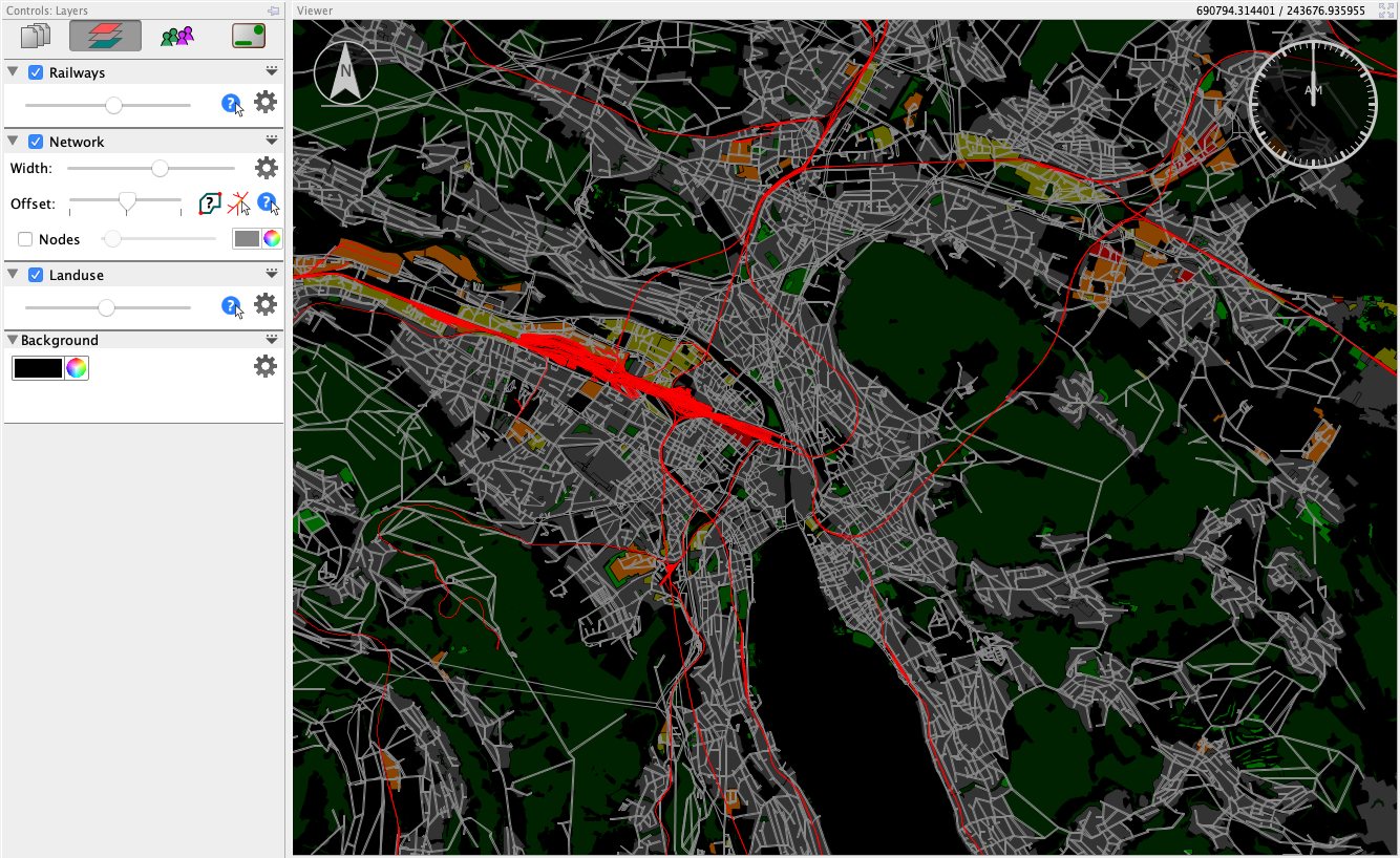
First, load a shape file (*.shp) as data source, then create a layer for it. If the shape file is shown in the wrong place, or even rotated, change the options in the data sources view. First, make sure the shape file is in the correct coordinate reference system (CRS). Next, if the shape file appears to be rotated and squeezed, select the checkbox “Use Long/Lat instead of Lat/Long”. This is due the fact that shape files (or more exactly: coordinate systems) do not specify if the first coordinate is the longitude or the latitude.
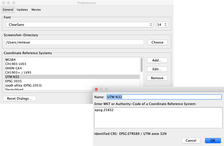
The list of available coordinate reference systems can be adapted in Via’s options (menu File > Options... on Windows and Linux, Via > Preferences... on macOS).
In the layer’s option menu (the triangle on the right side of the layer’s title), Shape layers offer the option to display a shape file only during a specific time window. This can be used e.g. to highlight areas in a time-dependent manner.
Customizing the list of available Coordinate Reference Systems
When loading Shape files, it may happen that the shapes are displayed distorted or at a wrong location. This is often due to the fact that the shapes’ coordinates do not match those of the network or other coordinates used in MATSim data. When loading Shape files, it is thus possible to transform the coordinates in the Shape file to another coordinate reference system. The list of available coordinate systems to transform from/to can be customized in Via’s preferences (on Windows and Linux: menu File > Options..., on macOS: menu Via > Preferences...).
To add another coordinate reference system (CRS), open the Options dialog and click on Add... next to the list of known coordinate reference systems. In the newly opened dialog, enter a name for the to-be-defined coordinate system and then enter the description of the coordinate system. As description, Via understands either an EPSG code in the form EPSG:4326 or a so-called ”well-known-text” (WKT) description of a CRS. A good reference for coordinate reference systems is spatialreference.org, where you can find the EPSG codes or WKT of a large number of coordinate reference systems worldwide.