Map Background
The Map Background plugin provides several possibilities to display maps as background images.
Table of contents
GeoTIFF Layer
Displays a raster image.
Requires a loaded GeoTIFF file.
This layer allows to display geo-referenced raster images, typically called GeoTIFF, in Via. These are pixel images where the image’s edges have coordinates assigned, so they can be displayed relative to other coordinates. Typical data sources for such images are satellite imagery, or sometimes also official city plans.
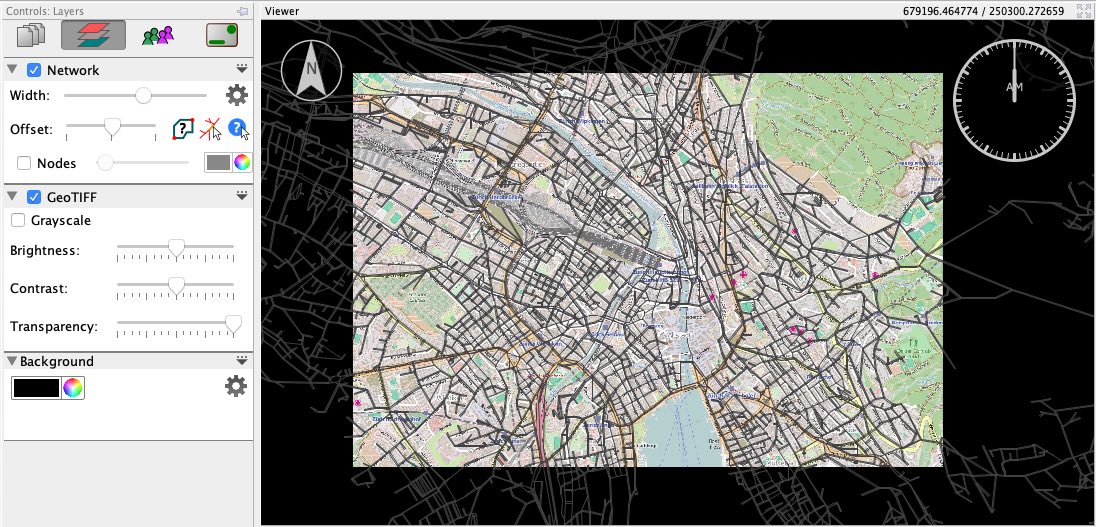
In most cases, GeoTIFF files actually come as two files: one ending on *.tiff (or *.tif) containing the actual image, and another ending on *.tfw — the so called world file — containing coordinates and other related data to position the image correctly on a map. The two files must have the exactly same name except the file ending.
Besides the typical TIFF files use for geo-referenced images, Via also supports the following additional image file formats along the corresponding world files:
- PNG images (
*.png) together with*.pgwworld files - JPEG images (
*.jpgor*.jpeg) together with*.jgwworld files - GIF images (
*.gif) together with*.gfwworld files
WebMap Layer
Displays maps from internet services.
Requires a working internet connection.
The WebMap Layer allows to display maps as backgrounds from several online sources, e.g. from OpenStreetMap, Bing or Google Maps.
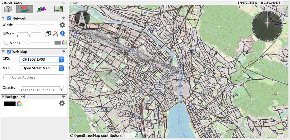
Maps on the internet typically use a special coordinate projection which will be different from the coordinate system you use for your data. In order to display the correct region on the Map given your data’s coordinates, you have to specify which coordinate system your visualized data is in. Just select from the menu to do so.
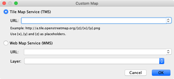
Via provides access to some background maps, but it is also possible to use custom map providers. Custom maps can either be provided from tile servers (TMS), or from Web Map Servers (WMS).